Cartegraph OMS includes two native mobile applications. Cartegraph for iPad is a comprehensive mobile application with offline mode capabilities. Cartegraph One is a lightweight mobile application that is compatible with both iOS and Android. Today, Cartegraph for iPad is the most popular mobile application among Cartegraph users.
Cartegraph for iPad and Cartegraph One Feature Comparison
Use this table to compare features for Cartegraph One and Cartegraph for iPad to see which will work best for you.
| Feature | Cartegraph for iPad | Cartegraph ONE |
| Accessible from Apple devices | X | X |
| Accessible from Android devices | X | |
| View, Edit, Create Assets | X | X |
| Perform 5-Star Inspections | X | X |
| Perform Advanced Inspections | X | |
| Exchange Component Assets | X | |
| Use Capture Feature to Create Assets | X | |
| View, Edit, Create Tasks | X | X |
| View and Edit Live Tasks | X | |
| View and Generate Routes for Tasks | X | |
| Enter Resources (labour, equipment, materials, additional expenses) | X | X |
| Customize Fields Available on Timesheet for Resource Entry | X | |
| Enter Materials with Material Locations | X | |
| Bar Code Scanning | X | |
| Attach Photos | X | X |
| View Records on a Map | X | X |
| View Assets and Tasks on a Single Map | X | |
| Access Filtered Asset Layers | X | |
| Access Custom Maps | X | X |
| Interact with Esri Web Maps | X | |
| Define Custom Zoom Extents with Web Maps | X | |
| View and Edit Requests | X | |
| Offline Mode Available | X |
Cartegraph for iPad
A powerful, field-ready app for organizations using Cartegraph. We’ve taken our Operations Management System and tailored it to work perfectly on your iPad. So, wherever the day takes you, you’ll have all the tools and resources you need to complete tasks accurately and on time.
- Easy sign in using your Esri arcgis.com credentials.
- Choose between your own ArcGIS Server hosted map or stock Apple Maps. Note: Cartegraph currently does not support secured map services for Cartegraph for iPad.
- Create point, line, and polygon assets. Edit asset, task, and request locations directly on your map.
- Create tasks, and associate them to Assets and Requests. Sort tasks by Priority, Date, or Proximity.
- Select a task from your list and automatically see it on your map. Select that point to view task details, including associated asset(s).
- Easily filter and select the asset layers you want to view.
- Enhanced functionality for conducting inspections and entering information on the spot.
- Enter labor hours, equipment, material, and other resources used to complete the task.
- See and edit the details of a task as you would on your desktop.
- Use the iPad camera as a bar code scanner to fill the Asset ID field.
- Attach photos to a given task using your iPad camera or choose a file from the Photo Library.
- View and edit open requests. Sort requests by Priority, Date or Proximity.
- Filter the request list on requests with or without associated tasks.
- Select a request from your list and automatically see it on your map. Select that point to view request details.
- View and generate route optimization for Tasks
- Exchange Assets, a malfunctioning one belonging to a container Asset.
- When an internet connection will not be available, use the Offline mode.
The Tasks and Requests lists can be sorted by the following:
- Priority: Highest to lowest
- Entry Date: Oldest to newest
- Proximity: Closest to farthest
Requests
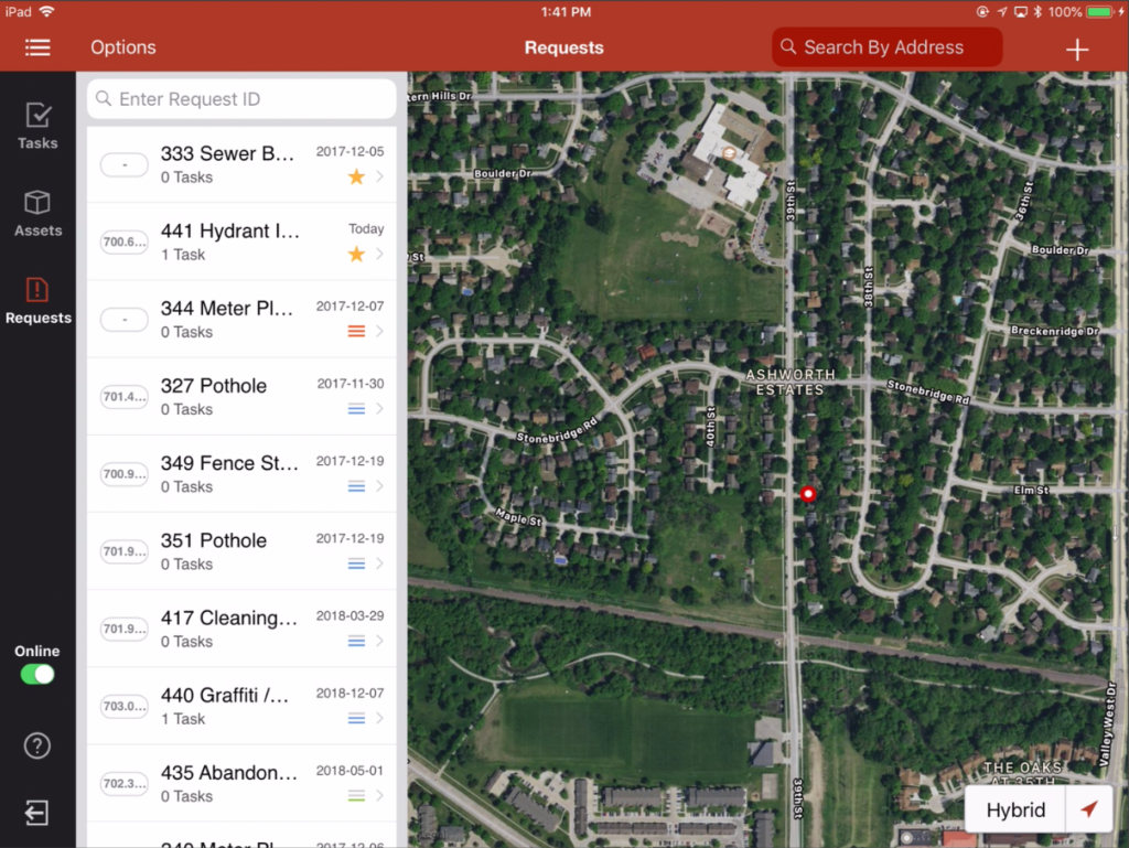
Requests display in a list in the Cartegraph for iPad app.
The list can filter requests by the following criteria:
- All Requests-Requests with a Status value of Open
- Tasks Assigned-Requests with a Status value of Open and one or more assigned Tasks.
- No Tasks Assigned-Requests with a Status value of Open and no assigned Tasks.
In all cases, the first Requests layer which is configured for the user in Cartegraph is used to enhance the Request filters in Cartegraph for iPad. The filters are combined using a logical AND, so in order for a Request to appear in the list, both filters must be satisfied. If the user has not configured a Requests layer in Cartegraph or has not applied a filter to their Requests layer, no extra filtering logic is applied.
*This feature is not available with Offline mode.
Request Detail
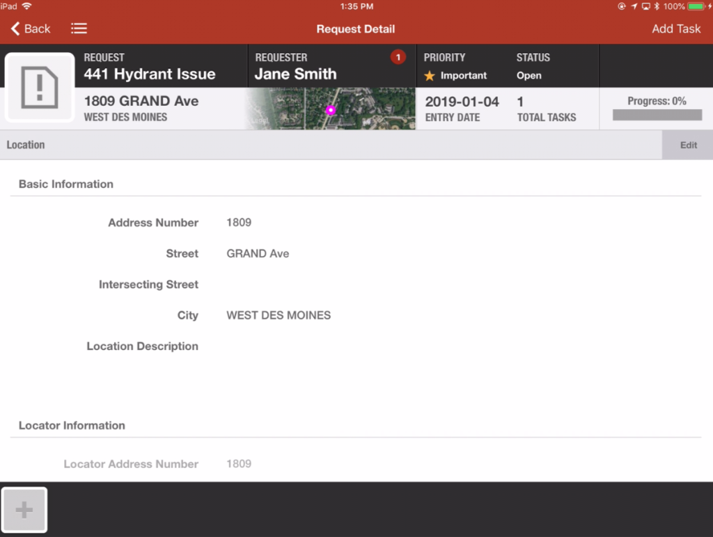
Using Cartegraph for iPad, a user will obtain the same request related information they would when using Cartegraph OMS. This includes access to request details such as a map, location information, an issue description alongside its priority and a standard operating procedure, requestor information and requestor logs, internal comments, a task summary (e.g. projected, planned, in progress, completed, and cancelled), attached files, and more.
Tasks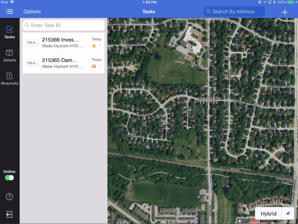
Tasks display in a list in the Cartegraph for iPad app. The list can filter tasks by the following criteria:
All My Tasks
Tasks display in the All My Tasks list if:
- The status is In Progress or Planned.
- There is a Start Date and it is less than five days in the future.
- Only Tasks assigned to the signed-in user or Tasks the signed-in user has Labor hours entered against.
My Tasks Today
Tasks display in the My Tasks Today list if:
- The status is In Progress or Planned.
- Today’s date is in the Task’s date range or after the range.
- Only Tasks assigned to the signed-in user or Tasks the signed-in user has Labor hours entered against.
My Tasks Today Examples
- On dates falling within the Task’s assigned date range.
- A task has a start date of 9/1 and a stop date of 9/4—that Task displays on the signed-in user’s My Tasks Today list on each date within that range until the Task is marked as completed and closed in Cartegraph.
- On dates that come after the Task’s assigned date range.
- A task has a start date of 9/1 and a stop date of 9/4, but today is 9/8—that Task stays on the signed-in user’s My Tasks Today list until the Task is marked as completed and closed in Cartegraph.
Live Tasks
Tasks display in the Live Tasks list if:
- The status is In Progress or Planned.
- There is a Start Date and it is less than five days in the future.
- Tasks are not assigned to the signed-in user or do not have Labor hours entered against them.
- Do not have an Assigned Labor associated with them.
- Are located in a specified spatial range of the signed-in user’s current location.
*This feature is not available when in Offline mode.
Task Detail
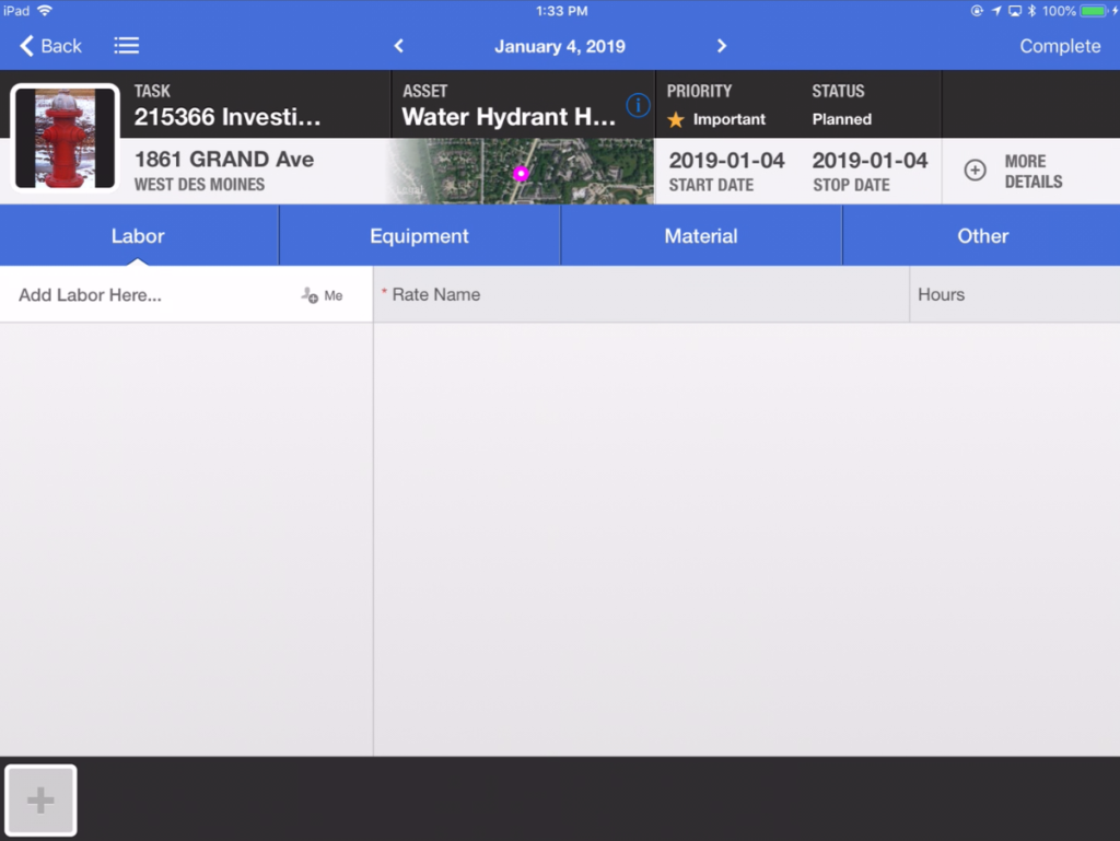
Using Cartegraph for iPad, a user will obtain the same task related information they would when using Cartegraph OMS. This includes access to task details such as a map, location information, a task description (e.g. activity type, asset identification, task priority and due date), resource records (e.g. labor, equipment, material, other), attached files, and more.
Asset Inspections
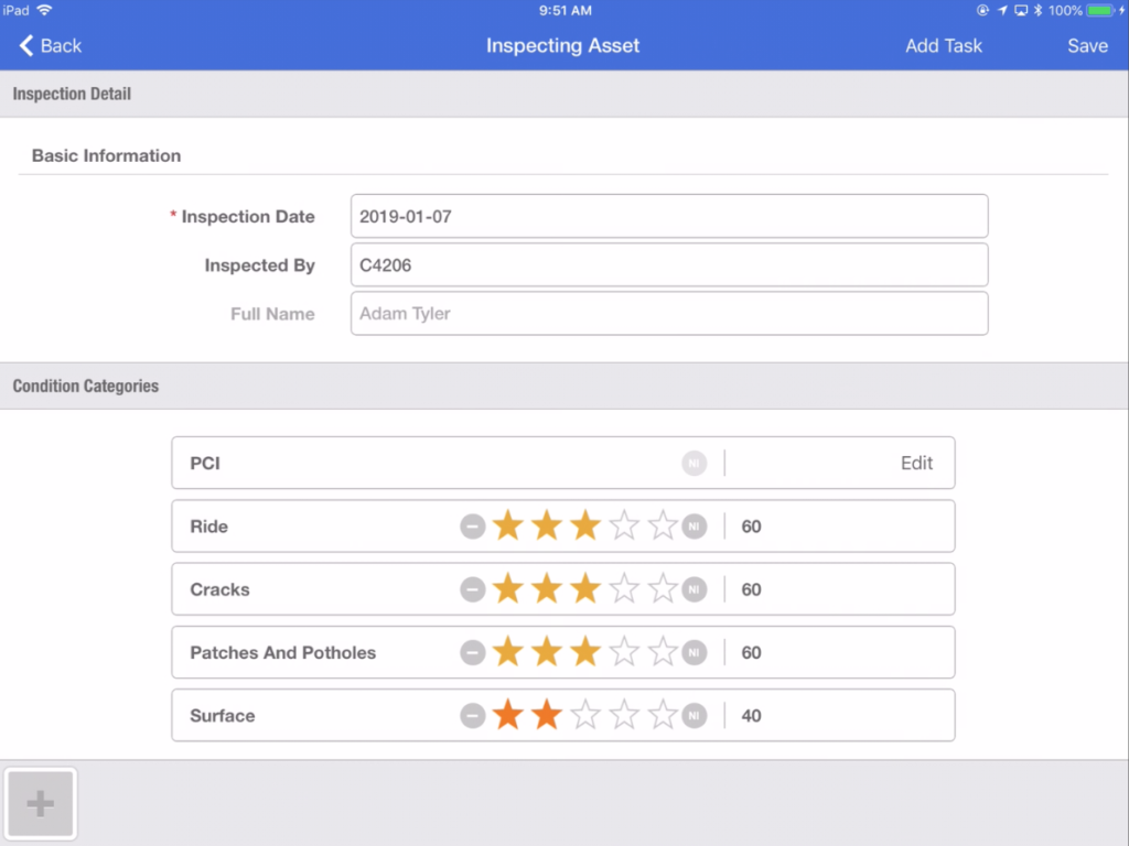
Asset inspections are easily completed using the Cartegraph for iPad application. A simplified interface guides the user through the inspection process, ensuring that all the pertinent information gets captured. Populate the data fields, attach notes and photos, and schedule necessary follow-up tasks on the spot. In the image above, a pavement segment inspection form is displayed.
Assets
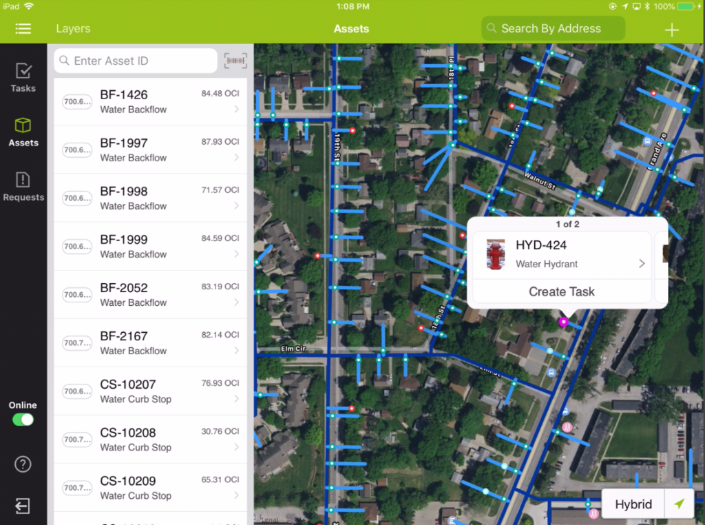
Control the Asset layers that display in the Cartegraph for iPad app.
- The asset layer stays in sync with the asset layers that display in the browser version of Cartegraph.
- The user has the ability to add and remove asset layers on the tablet.
- The order and color of the layers can be edited.
- Multiple layers of the same asset will display on the tablet.
*This feature is not available in Offline mode.
Asset Detail
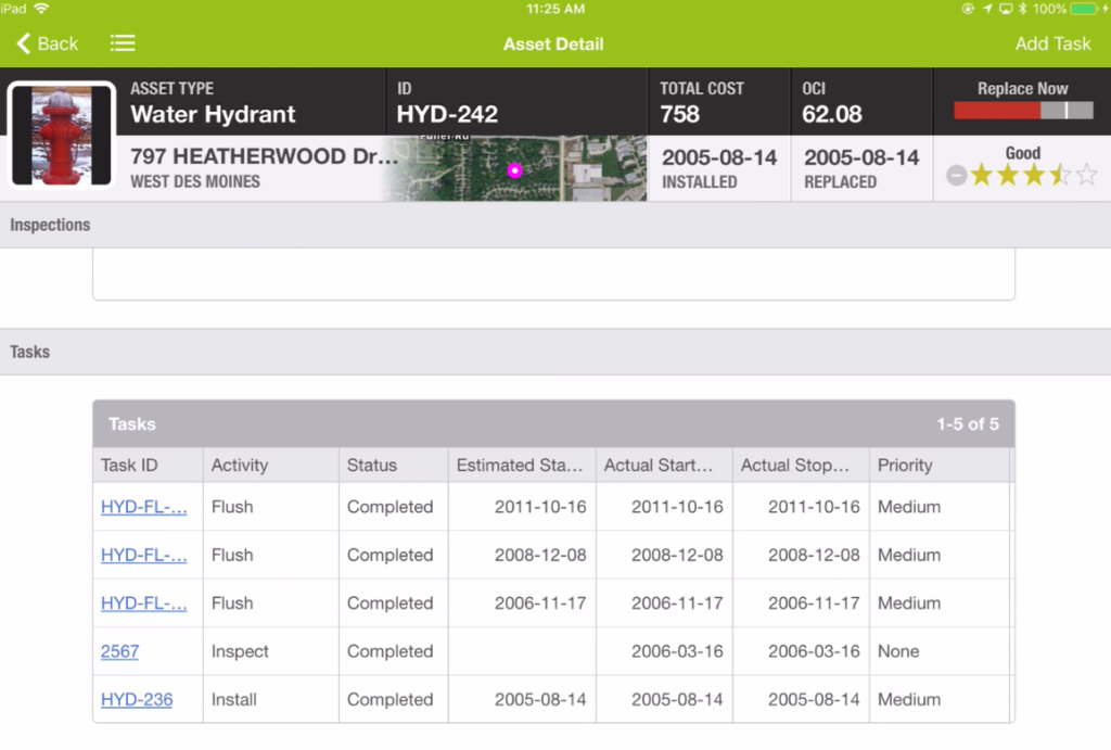
Using Cartegraph for iPad, a user will obtain the same asset related information they would when using Cartegraph OMS. This includes access to asset details such as a map, location information, specifications, inspection history, task history (e.g. projected, planned, in progress, completed, and cancelled), linked assets, and attached files. Also included is a replacement rating, a condition rating, the estimated OCI, and the total cost of the asset to date.
Route Optimization
Mobile route optimization is an extension of the browser route optimization functionality. Select Route Options from the Options menu on the Task list.
Planned Routes
Planned routes are routes generated and saved in Cartegraph.
- Select this option to view a list of all routes containing at least one task assigned to the signed-in user or where the signed-in user has labor hours entered.
- Select this option to filter the Task list to all open tasks on that route, whether the user is assigned to the task or not, in the correct routed order.
Generated Route
This option is available to reselect the last route generated on the device.
- Switch quickly to another filter/sort to check out other tasks or see if any new work has popped up, but you do not necessarily want to change the route you were going through.
- This option is available as long as you have generated a route on the tablet, and at least one of the tasks on that route is open.
Generate New
This option generates a new route from the tablet.
- This route is only stored on the tablet.
- Once a route generates, it is available to reselect via the Generated Route option.
- A list of how many Tasks to route displays. For example, 5, 10, 25, or 50.
- An optimized task list generates based on the top 5, 10, 25, or 50 Tasks according to the current filter and sort.
- Select the ending location. The current GPS position is always used for the starting location.
The Save End Location and Clear End Location on Next Sign In app settings help configure the routing experience. See the Cartegraph for iPad App Settings section to learn more.
*This feature is not available in Offline mode.
Bar Code Scanning
Cartegraph for iPad has the ability to scan bar codes to place an Asset’s ID into fields throughout the application. All bar code types are supported. Bar codes make data collection faster and more accurate by scanning data instead of entering it.
Tap the Bar Code Scan button next to the ID field and aim the iPad’s camera lens at the Asset’s bar code. After the scan completes, the Asset ID displays in the field.
Start the scan from the following Asset ID field locations:
- Asset list
- Asset’s Detail view
- Task’s Detail view
- Create an asset guided process
- Material Resource Entry
Offline Mode
The Offline mode is useful for when the app will be used in circumstances where there is unreliable Internet access. Where there is reliable Internet access, remaining in Online mode will continue to provide the best experience. In Offline mode, users can download the data they need to work without an Internet connection, record their changes as they typically would while Online, and go back into Online mode to save their changes to the OMS server.
*This feature is not available in Offline mode.
Cartegraph One
Use Cartegraph One to collect assets, maintain them, and track associated costs. Simple, fast, and effective asset management on iOS or Android smartphones. Wherever the day takes you, you’ll have all the tools and resources you need to complete tasks accurately and on time.
- Use innovative image capture technology to shorten your asset collection time
- Quickly collect assets and build an accurate asset inventory
- Create tasks to inspect, repair, or maintain your infrastructure assets
- Complete tasks on-the-go, marking them complete in real-time
- Enter time, equipment, materials, and other resources used to complete the task
- View tasks and assets on an Esri map. Only see the tasks that are assigned to you
- Tap on any task on the map to view task details, including associated assets
- Perform 5-star inspections, including Ra for signs and appraisals for trees
- Attach images to assets and tasks, selecting an image to display
- Create point, line, and polygon assets. Edit asset and task locations directly on your map
- Create tasks for Assets and/or Non-Assets. Sort tasks by Priority, Date, or Proximity
Tasks and Task Detail
 |
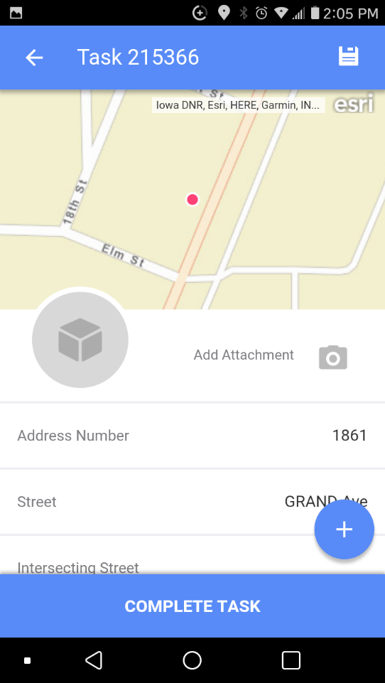 |
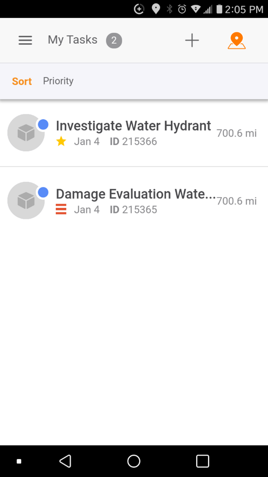
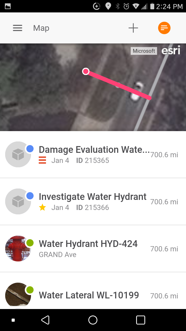
View the work assigned to the signed-in user on the My Tasks list:
- Status must be Planned or In Progress
- Task assignment for the Labor record associated to the signed in user, or there must be one or more Labor Logs for the Task for the Labor record associated to the signed in user
- From the map, tap the orange list icon on the right of the header bar. Tap on the task in the list to see its details.
Sort the List:
- Date-Start Date oldest to newest
- Priority-Highest to lowest
- Proximity-Closest to farthest based on the current location
Refresh the Task list by pulling down on the list and releasing.
Assets and Asset Detail
 |
 |
- Custom basemaps and two Esri community basemaps are available for customers without an ArcGIS identity.
- Customers with an ArcGIS identity have access to the same maps they do in AGOL, as well as about a dozen Esri community maps. This is limited to 200 maps.
- When the Esri default basemaps are not on the list of available maps for users, Cartegraph One will function the same as our web browser application; the user will be presented with the first map in the list instead.
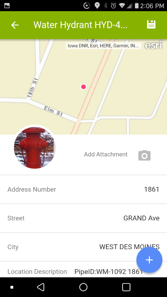
- The selected map displays the location of tasks (blue) and assets (gray).
- Layer settings persisted on in the app and are independent of the desktop version.
- The map displays records based on the Cartegraph Layers that are turned on.
User Interface
- Analytics Dashboard
- Navigation Persistence
- Global Search
- Table of Contents/ Layers
- Map Tools
- Documents Attachments
- List View Data Export
- More Information…
Request Management
Work Management
- Work Orders
- Repeating Work Orders
- Tasks
- Activities
- Task Calendar
- Time Sheets
- Distribute Resources
- Task Triggers
- Preventative Maintenance
- More Information…
Asset Management & Analytics
Resource & Inventory Management
Report Management
Mobile Management
- Cartegraph for iPad and Cartegraph One Feature Comparison
- Cartegraph for iPad
- Cartegraph One
- More Information…
Workflow Management
System Management
- Structure Manager
- Library Manager
- Layout Manager
- Esri and Active Directory
- Security Role Administration
- System Licensing
- System Requirements
- More Information…
