Use OpenGov EAM to collect assets, maintain them, and track associated costs. Simple, fast, and effective asset management on iOS or Android smartphones. Wherever the day takes you, you’ll have all the tools and resources you need to complete tasks accurately and on time.
- Use innovative image capture technology to shorten your asset collection time
- Quickly collect assets and build an accurate asset inventory
- Create tasks to inspect, repair, or maintain your infrastructure assets
- Complete tasks on-the-go, marking them complete in real-time
- Enter time, equipment, materials, and other resources used to complete the task
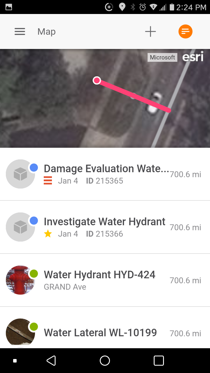
- View tasks and assets on an Esri map. Only see the tasks that are assigned to you
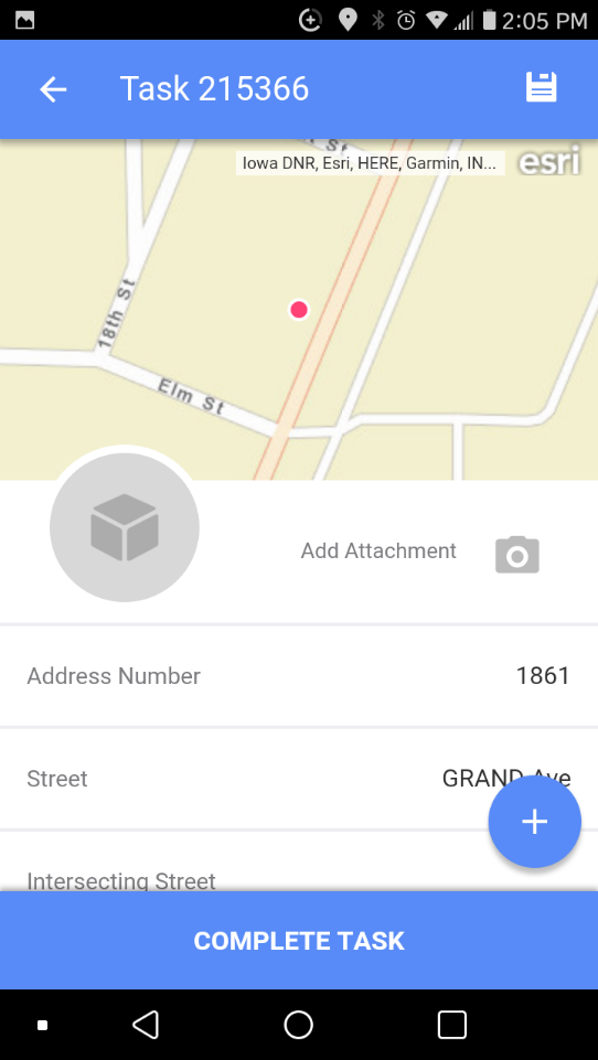
- Tap on any task on the map to view task details, including associated assets
- Perform 5-star inspections, including Ra for signs and appraisals for trees
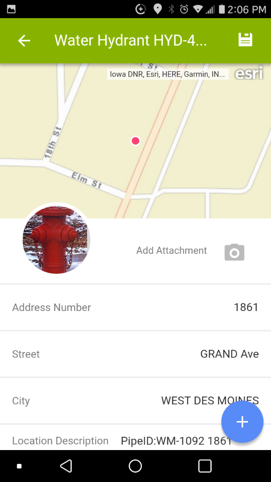
- Attach images to assets and tasks, selecting an image to display
- Create point, line, and polygon assets. Edit asset and task locations directly on your map
- Create tasks for Assets and/or Non-Assets. Sort tasks by Priority, Date, or Proximity
Tasks and Task Detail
 |
 |
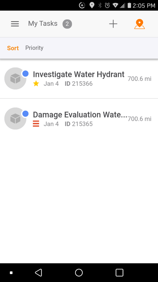
View the work assigned to the signed-in user on the My Tasks list:
- Status must be Planned or In Progress
- Task assignment for the Labor record associated to the signed in user, or there must be one or more Labor Logs for the Task for the Labor record associated to the signed in user
- From the map, tap the orange list icon on the right of the header bar. Tap on the task in the list to see its details.
Sort the List:
- Date-Start Date oldest to newest
- Priority-Highest to lowest
- Proximity-Closest to farthest based on the current location
Refresh the Task list by pulling down on the list and releasing.
Assets and Asset Detail
 |
 |
- Custom basemaps and two Esri community basemaps are available for customers without an ArcGIS identity.
- Customers with an ArcGIS identity have access to the same maps they do in AGOL, as well as about a dozen Esri community maps. This is limited to 200 maps.
- When the Esri default basemaps are not on the list of available maps for users, OpenGov EAM will function the same as our web browser application; the user will be presented with the first map in the list instead.
- The selected map displays the location of tasks (blue) and assets (gray).
- Layer settings persisted on in the app and are independent of the desktop version.
- The map displays records based on the OpenGov EAM Layers that are turned on.
User Interface
- Analytics Dashboard
- Navigation Persistence
- Global Search
- Table of Contents/ Layers
- Map Tools
- Documents Attachments
- List View Data Export
- More Information…
Request Management
Work Management
- Work Orders
- Repeating Work Orders
- Tasks
- Activities
- Task Calendar
- Time Sheets
- Distribute Resources
- Task Triggers
- Preventative Maintenance
- More Information…
Asset Management & Analytics
Resource & Inventory Management
Report Management
Mobile Management
- Cartegraph for iPad and Cartegraph One Feature Comparison
- Cartegraph for iPad
- Cartegraph One
- More Information…
Workflow Management
System Management
- Structure Manager
- Library Manager
- Layout Manager
- Esri and Active Directory
- Security Role Administration
- System Licensing
- System Requirements
- More Information…