Map View
The Map view displays the location of Assets, Requests, Tasks, and Work Orders with associated Tasks, if the record has a location specified. This allows you to visually track every part of your day-to-day operations.
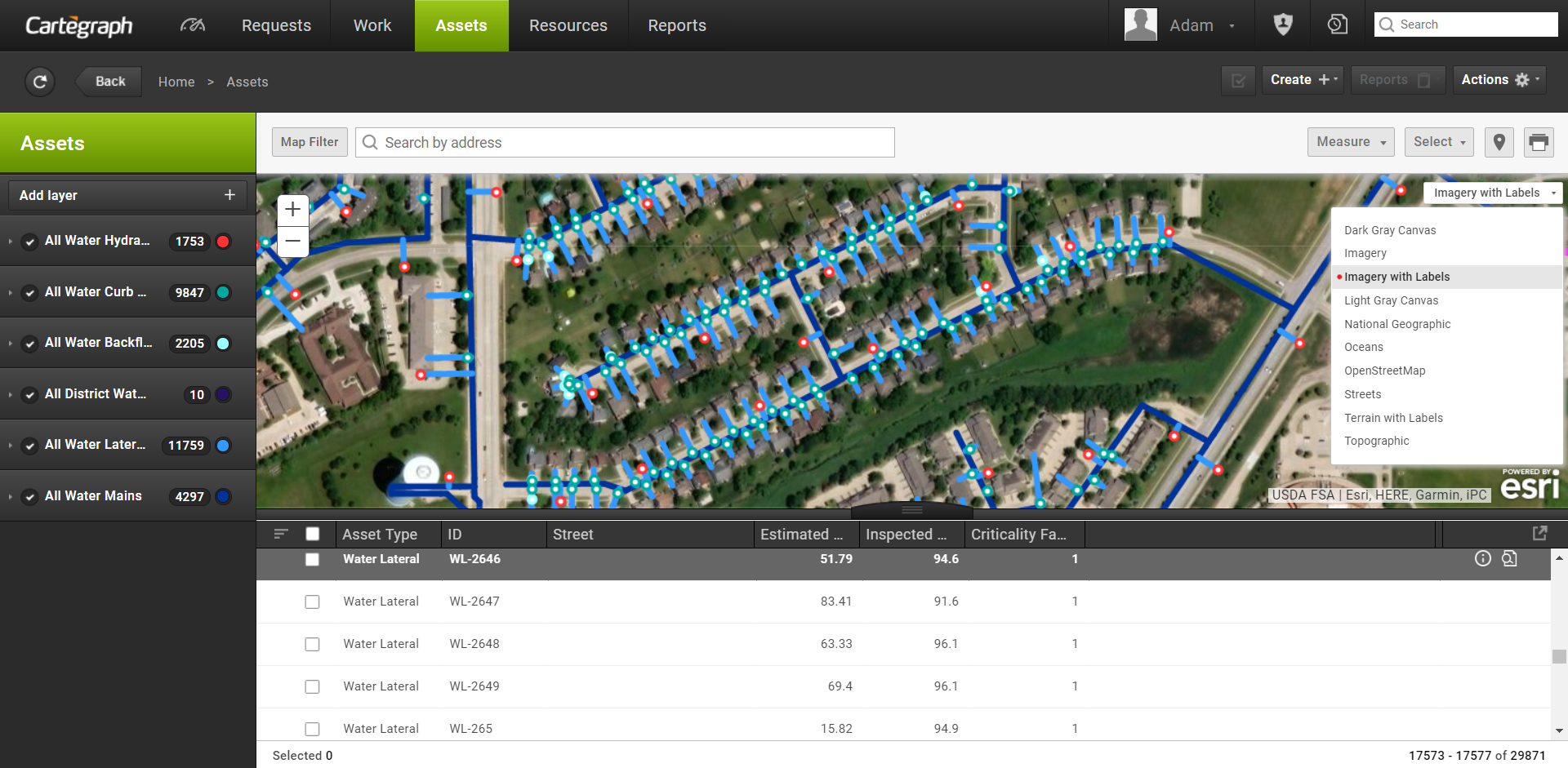
- The Map view uses Esri maps and their different view types. For example, imagery and street.
- The Map view and List view work together to display the records in the List view with locations.
- If more than one map symbol is at the location you click, the Multiple Record mini-map tip displays, allowing you to scroll through each record at that location.
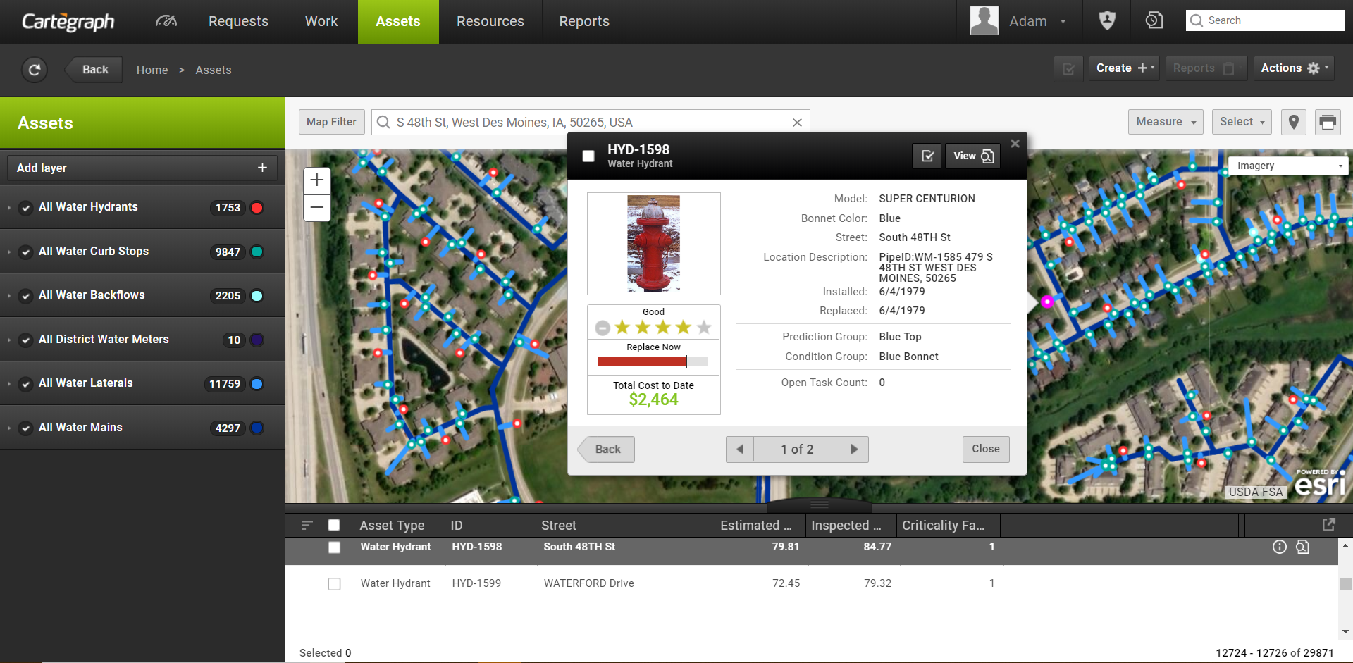
- Click any map symbol to view a Mini-Map tip identifying the record.
- In the Mini-Map tip, click View to go to the Detail view of the selected record.
- In the Mini-Map tip, click to view a summary of the record in the Summary tip.
- Work Order Summary tips display the Work Order Details and Work Order Task information.
- Task Summary tips display the Task detail and Asset detail if the Task is associated to an asset.
- Asset Summary tips display some Asset detail.
- When too many records are in one area of the map, displays in the map view. with a message that not all records are displayed in the map. Zoom in or add a filter to decrease the number of records to display.
- The currently selected record displays on the map in magenta.
- When Map view is zoomed into specific records click Map Filter to display the records in List view. When Map filter is cleared the List view displays the previous records.
- In the Address Search field, enter an address or longitude/latitude coordinates. A suggestion list opens as you type. Press the Enter key to move the map pin to the location specified in the search field or select the desired suggestion in the list to move the map pin to that location.
If anything is highlighted in the suggestion list, press the ENTER key to use the highlighted selection in the suggestion list.
- Click X in the search field to close the suggestion list and clear the search field. Examples of supported longitude/latitude coordinates for the World Geocode service, which is the default geolocation service. Leading zeroes are optional:
- 641988 N42.491288
- 641988, N42.491288
- -090.641988 042.491288
- -90.641988, 42.491288
- This is an example of supported longitude/latitude coordinates for an alternative Esri locator, -90.641988, 42.491288
- Click Current Location to center the map to your location.
- Click Print Map to print the map currently displayed.
- Use the Selection Tool to draw a polygon around map symbols to select a group of records. The shape must be a polygon, and the lines of the polygon cannot cross. The records selected in the map display as selected in the List view. Click one of the map symbols to scroll to that record in the list.
- To clear the selection, clear all selections in the List view or clear and reselect the layer in the Layer panel.
If you have an ArcGIS Named User License, these features are also available:
- Click Select to select items in the map using one of the available tools:
- Draw polygon
- Radial Distance
- Linear Offset
- Polygon Offset
- Spatial Analysis—Only available in Asset List map
- Click Measure to measure the area of a polygon, the length of a line, or find the coordinates of a point.
Cartegraph Basemaps
The Cartegraph Map view contains basemaps configured in ArcGIS Online or Portal, based on the Esri permissions of the signed in Cartegraph user. These include web maps:
- Shared to the organization’s Basemap Gallery
- Shared to the Organization
- Shared to any Groups the Cartegraph user belongs to
- Owned by the Cartegraph user
To limit the Esri web maps that display in Cartegraph, have the Esri Administrator create a Group, share only the desired Esri web maps with this group, and then set the Basemap Gallery to use this group. All users part of the organization sees at least these maps in Cartegraph. See the Basemap Gallery setup in ArcGIS Online or Portal topic for more information.
In addition to the Basemap Gallery maps and web maps created by the user, web maps created by individuals in the organization that are shared to the organization or to specific groups also display in the Cartegraph map view, based on the user.
To further limit the web maps that display in the Cartegraph map view, have the Cartegraph Administrator edit the ArcGISWebMapTag system setting. Only web maps that contain that tag are displayed, based on the above criteria. Web map tags are configured in ArcGIS Online or Portal.
Esri web maps that are shared as Public in ArcGIS Online or as Everyone in Portal for ArcGIS Online are not available in Cartegraph.
If no maps are configured in ArcGIS Online or Portal, the Esri Streets map displays in the Cartegraph Map view.
Map Selection Tools
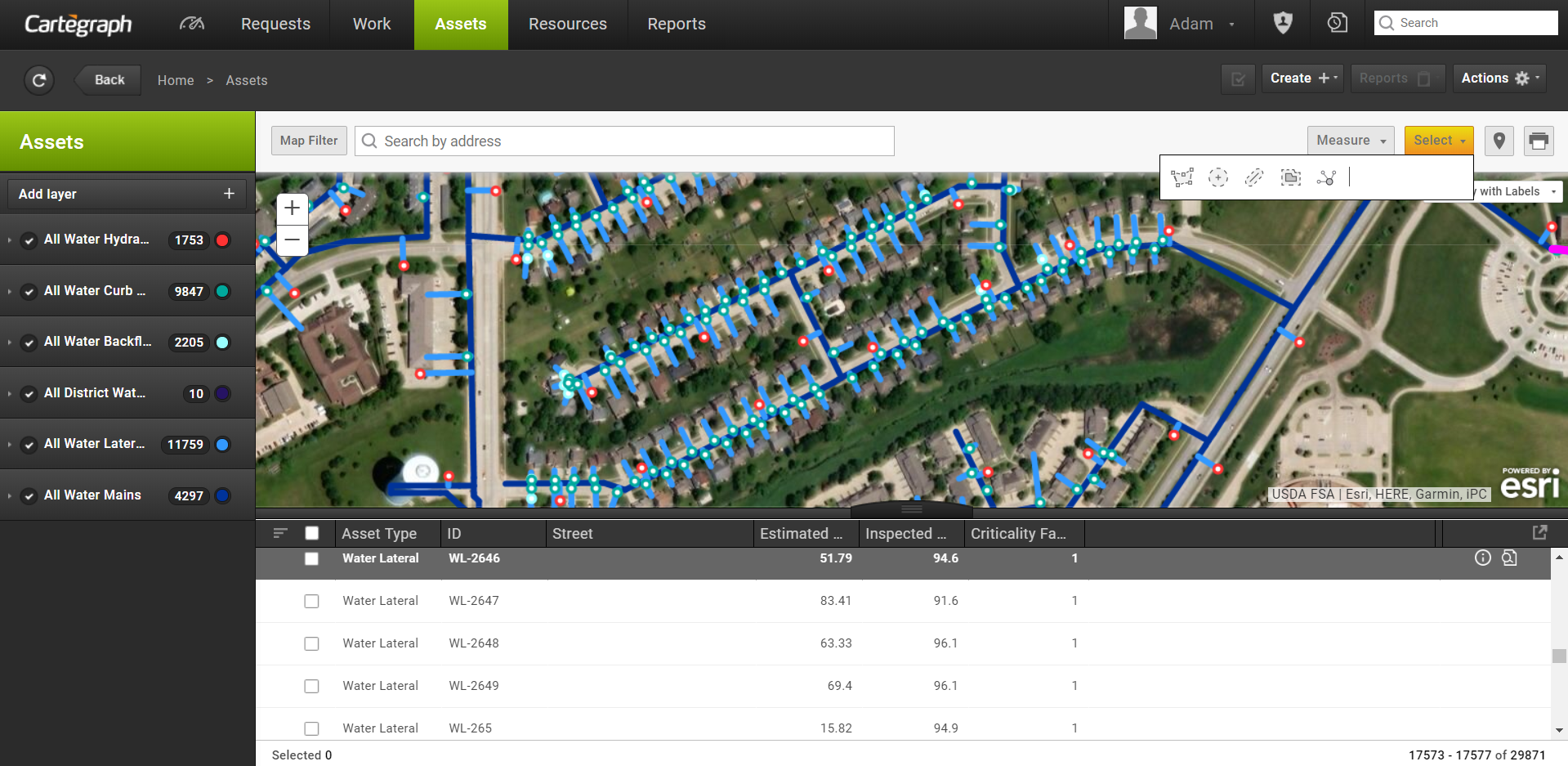
When using a Cartegraph map you can select a group of records through different tools in the Select menu, instead of manually selecting each record.
The Select tool is available in different maps:
- List view maps when a layer is turned on.
- Work Order Detail map when at least one Task status check box is selected.
- Container Component tab when at least one layer is turned on.
- Create Task from Request when an Asset type is selected (not Non-Asset).
The Select tool contains different tools. Once any of the tools are used, the selected records in the map display as selected in the List view. Sort Selected Records is turned on to bring the selected records to the top of the list.
Use the Draw Polygon tool to draw a polygon shape around records in the map.
Use the Radial Distance tool to select records within a certain distance from a point in the map.
Use the Linear Offset tool to select records within a certain distance from a linear record in the map.
Use the Polygon Offset tool to select records within a certain distance from a polygon record in the map.
Use the Spatial Analysis tool (only available on the Asset List view) to select records based on queries against other Cartegraph layers or Esri layers.
Map Measure Tools
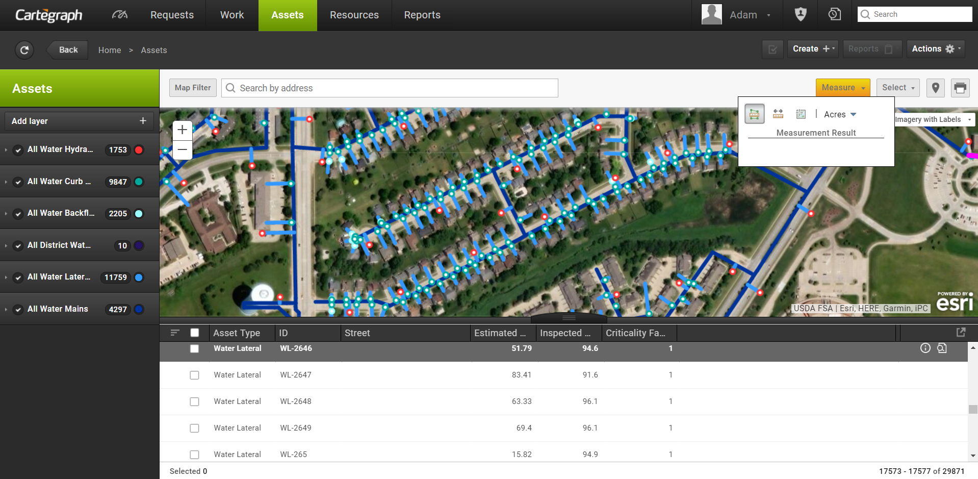
When using most maps in Cartegraph, you can measure the area of a polygon, the length of a line, or find the coordinates of a point.
Make a Measurement
- Click the Measure button to display the toolbar and use one of the measure options.
- To measure an area on the map, click and click the map once for every vertex of the area you want to measure. Double-click to complete the area.
- To measure a line on the map, click and click the map once for every vertex of the line you want to measure. Double-click to complete the line.
- To get coordinates for a point on the map, click and click the map at the location where you want to get coordinates.
- Your results display in the bottom of the toolbar.
- To turn off the Measure Tool, click the Measure button. Turning off the Measure Tool clears any previous measurement results.
Change the Units
Each option in the measurement tool has its own set of corresponding units.
Click the Unit field for the selected measurement option to change the unit of measurement. The selected units stay selected for each measurement tool.
Spatial Analysis
When using the map in the Assets page in Cartegraph, select assets based on a set of spatial or attribute queries run against other Cartegraph Asset layers and/or Esri layers in the map. The Spatial Analysis tool is available when Cartegraph is authenticated with ArcGIS Online or with Portal for ArcGIS configured with Data Store.
Target Layer
- The Target layer must be an active Cartegraph layer that contains at least one record with a location.
- The analysis returns records that are in the Target layer.
Analysis Layers
- All active Cartegraph asset layers can be used in the analysis as long as they contain at least one record with a location.
- Esri layers available for analysis come from the current map.
- Any layers in the map that support the analysis capability can be used.
- If the current map does not have any layers, then no Esri layers are available in the analysis. For example, the Streets map.
- The logged in user must have access to the layer, based on the corresponding Esri Authentication.
- Web Feature Services (WFS) layers are not supported in Cartegraph.
- Living Atlas
- The Living Atlas contains a set of free layers that are part of the ArcGIS Living Atlas of the World.
- To limit the number of maps available based on your current map extent, select the Within map area check box.
- To add a layer to your map temporarily, select the Add layer to map check box.
Expressions
- You must add at least one expression in order to run the analysis.
Analysis Results
The returned records are selected in the map and the index list.
- A maximum of 2,500 results can be selected in the List view. If more results are returned, a message displays the returned results count.
- Esri returns a maximum of 9,999 results.
To limit the results of the analysis to only the assets within the map window, select the Use current map extent check box.
NOTE: If the Map Filter is turned on in the Cartegraph map, the Use current map extent option cannot be cleared.
Credits
The Spatial Analysis feature consumes Esri credits. Use the layer filters and map filter to decrease the number of records in the layer to lower the consumption of credits.
*This feature requires an ArcGIS Identity.
User Interface
- Analytics Dashboard
- Navigation Persistence
- Global Search
- Table of Contents/ Layers
- Map Tools
- Documents Attachments
- List View Data Export
- More Information…
Request Management
Work Management
- Work Orders
- Repeating Work Orders
- Tasks
- Activities
- Task Calendar
- Time Sheets
- Distribute Resources
- Task Triggers
- Preventative Maintenance
- More Information…
Asset Management & Analytics
Resource & Inventory Management
Report Management
Mobile Management
- Cartegraph for iPad and Cartegraph One Feature Comparison
- Cartegraph for iPad
- Cartegraph One
- More Information…
Workflow Management
System Management
- Structure Manager
- Library Manager
- Layout Manager
- Esri and Active Directory
- Security Role Administration
- System Licensing
- System Requirements
- More Information…